High-performance, web-enabled, standards-compliant Maritime Information System — deployed on six continents, tracking over 300,000 vessels.
MariWeb is a high-performance, web-enabled, standards-compliant Maritime Information System that enables Aids to Navigation (AtoN), Maritime Domain Awareness (MDA) and e-Navigation systems.
MariWeb has been deployed globally, including in Australia, Canada, Turkey, Belgium, Greece, France, Uruguay, Croatia, New Zealand, the United Kingdom and the United States of America — with a world-class history of stability, features and support.
The latest version of MariWeb is built on 20 years of focused AIS-centric Maritime Information System development, using the latest software technologies, methods and applicable standards. This includes the Internet of Things (IoT), the VHF Data Exchange System (VDES) and 3GPP LTE for both IoT and maritime-centric data distribution and collection applications. IoT systems enable collection of data from meteorological, hydrographic and similar sensors.

When using coastal surveillance radars, target detection and extraction are implemented at each radar sensor — reducing the need for high-bandwidth, high-availability and low-latency data links between radar sensors and the central information systems.
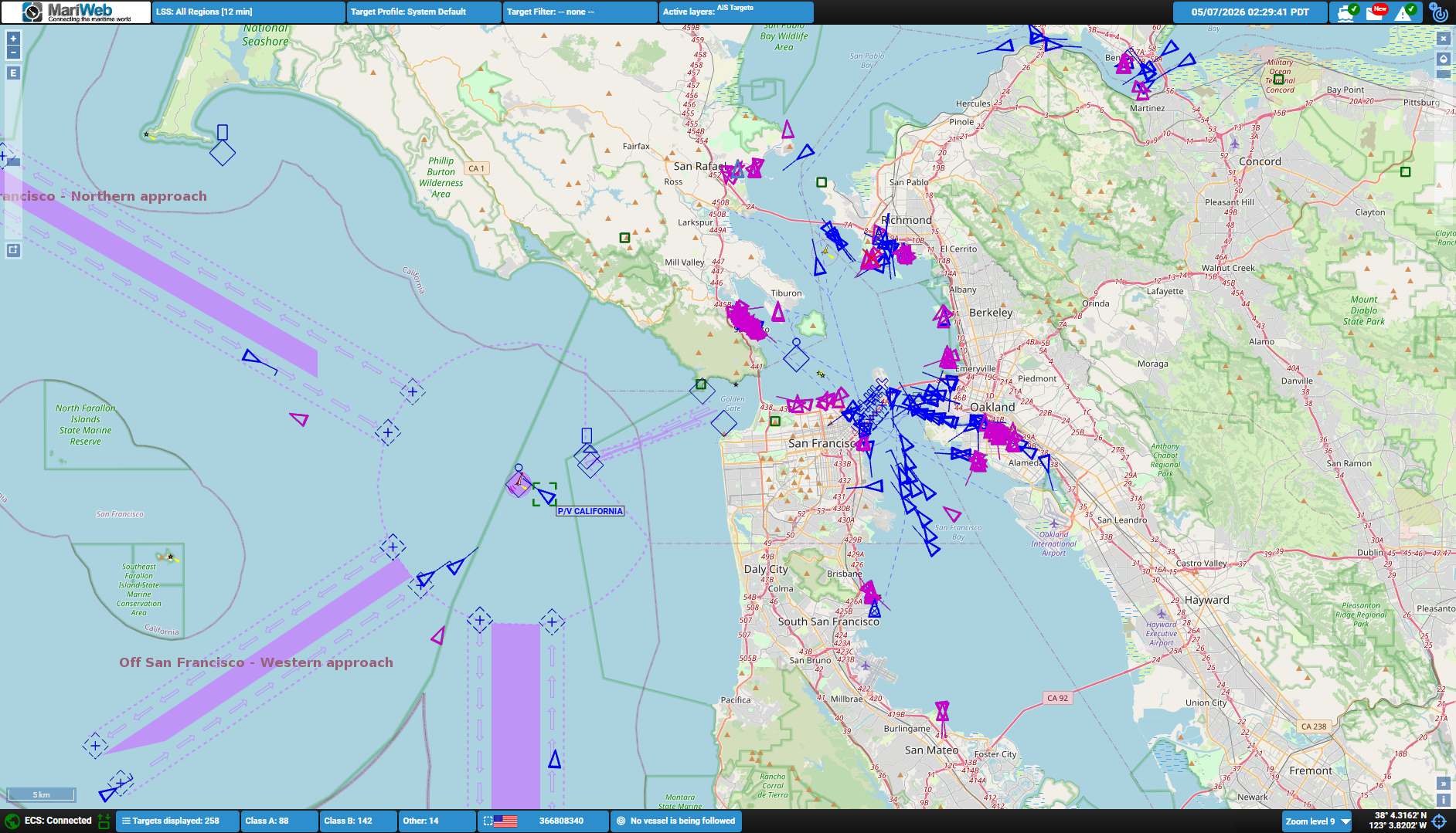
MariWeb delivers a near-real-time HMI using secure and encrypted (HTTPS) communications protocols to a responsive Graphical User Interface (GUI) accessible in any modern internet browser. All functions open within the same browser application as separate windows. The system topology includes multiple levels of resilience, ensuring operational availability exceeds 99.9% on a consistent basis.
Close attention has been paid to Cyber Security at every level. The unique MariWeb Security Application (MSA) analyses the timing, source and content of every AIS and IEC 61162-1 compliant message, testing each against a wide range of criteria and ensuring only valid, accurate messages are processed. This enhances operator confidence and overall system safety.
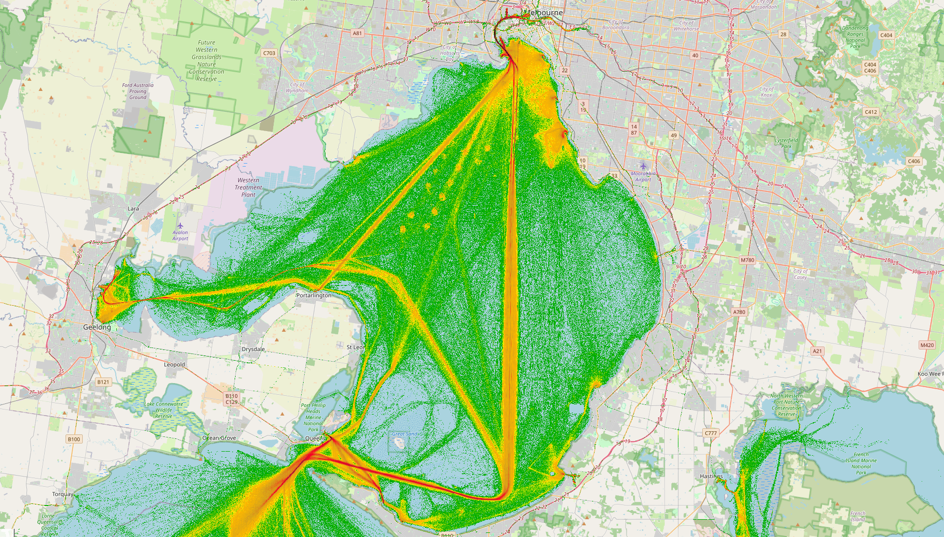
MariWeb provides both streaming and historical analytic capabilities. Streaming analytics are available as dashboards with a wide variety of graphs, or as configurable events processed in real time by the MariWeb Event Manager (MEM). Once an event is detected, appropriate alerts are triggered — from audible alerts and emails through to AIS messages transmitted to ships. Historical analytics query the GIS-enabled database to generate a wide range of location, asset and status-based reports, including high-resolution vessel density charts via the MariWeb Analytic Platform (MAP).